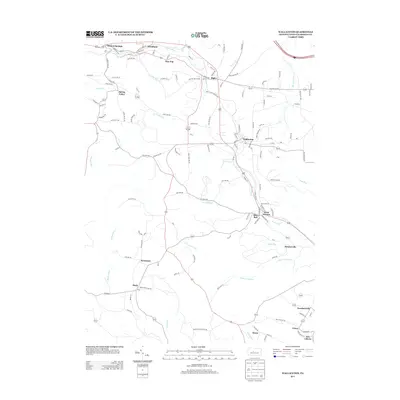
2013 Map of Wallaceton
USGS Topo · Published 2013About this map
Wallaceton and Bigler anchor this Clearfield County landscape, showing the distribution of small communities and the networks connecting them in the early 21st century. The geography is defined by a series of named waterways, including Roaring Run, Long Run, and Laurel Run, which have historically shaped the settlement patterns and road placements in this part of Pennsylvania. Local history is reflected in several distinct hamlets such as Blue Ball, Newtown, and West Decatur, which maintain their identity even as regional infrastructure evolved. For genealogists, the map provides the exact location of the Baughman Cemetery south of Drane. The presence of labels like Mutton Hollow Rd and Gray Hollow Rd suggests the local topography that dictated the placement of these established rural villages and transport routes.
Find a feature on this map
131 named features on this map. Tap any name to fly to it.
Don’t see what you’re looking for? This feature index may not catch every label — zoom into the map to look around manually.
Map Details
Editions of this 2013 Wallaceton Map
This is the sole edition of this map. No revisions or reprints were ever made.
Other maps of this area

1903 · Houtzdale
USGS Topo · 1:62,500

1905 · Houtzdale
USGS Topo · 1:62,500

1922 · Philipsburg
USGS Topo · 1:62,500

1929 · Karthaus
USGS Topo · 1:62,500

1929 · Clearfield
USGS Topo · 1:48,000

1932 · Clearfield
USGS Topo · 1:62,500

1932 · Karthaus
USGS Topo · 1:62,500

1939 · Philipsburg
USGS Topo · 1:62,500

1944 · Houtzdale
USGS Topo · 1:24,000
1944 · Glen Richey
USGS Topo · 1:24,000
Featured Places
- Bigler, Bradford Township
- Wallaceton, PA
- Pine Top, Bradford Township
- Decaturville, Decatur Township
- New Liberty, Decatur Township