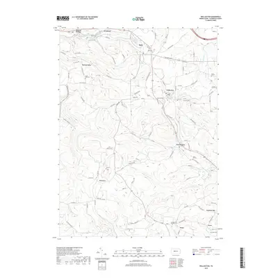
2019 Map of Wallaceton
USGS Topo · Published 2019About this map
Wallaceton serves as a central hub in this section of Clearfield County, where the local road network connects several small communities and family landmarks. The landscape is defined by the winding paths of Laurel Run and Morgan Run, which cut through the terrain near settlements like Bigler and West Decatur. For those researching local lineages, the map identifies numerous small burial grounds, including the Goss Cem near Newtown and the Summit Hill Cem to the east. These sites, along with Baughman Cem and the Centre United Methodist Cem near Drane, provide specific geographic anchors for tracing family history. The transition from established town centers to more remote areas is marked by distinct landmarks like Hogback Hill and Eagle Eye Rd, illustrating the intersection of residential life and the natural geography of central Pennsylvania.
Find a feature on this map
96 named features on this map. Tap any name to fly to it.
Don’t see what you’re looking for? This feature index may not catch every label — zoom into the map to look around manually.
Map Details
Editions of this 2019 Wallaceton Map
This is the sole edition of this map. No revisions or reprints were ever made.
Other maps of this area

1903 · Houtzdale
USGS Topo · 1:62,500

1905 · Houtzdale
USGS Topo · 1:62,500

1922 · Philipsburg
USGS Topo · 1:62,500

1929 · Karthaus
USGS Topo · 1:62,500

1929 · Clearfield
USGS Topo · 1:48,000

1932 · Clearfield
USGS Topo · 1:62,500

1932 · Karthaus
USGS Topo · 1:62,500

1939 · Philipsburg
USGS Topo · 1:62,500

1944 · Houtzdale
USGS Topo · 1:24,000
1944 · Glen Richey
USGS Topo · 1:24,000
Featured Places
- Bigler, Bradford Township
- Wallaceton, PA
- Pine Top, Bradford Township
- Decaturville, Decatur Township
- New Liberty, Decatur Township