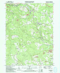
1993 Map of Wallaceton
USGS Topo · Published 1994About this map
The borough of Wallaceton serves as a central hub in this Clearfield County landscape, where the legacy of Pennsylvania's coal industry is visible through numerous Strip Mine operations scattered across the townships of Boggs and Decatur. Transport networks define the settlement patterns here, including the Conrail lines and the distinctive remnants of the Old Grade RR. In the eastern portion of the map, the community of Blue Ball (West Decatur PO) is established along Simeling Run, while the northern reaches include the settlements of Woodland and Bigler. This era reveals a densely developed social fabric of small-town life, evidenced by the high concentration of country houses of worship like Butterworth Grove Ch and Lighthouse Ch, alongside community landmarks such as the Wallaceton-Boggs Sch and the Bradford Sch.
Find a feature on this map
61 named features on this map. Tap any name to fly to it.
Don’t see what you’re looking for? This feature index may not catch every label — zoom into the map to look around manually.
Map Details
Editions of this 1993 Wallaceton Map
This is the sole edition of this map. No revisions or reprints were ever made.
Other maps of this area

1903 · Houtzdale
USGS Topo · 1:62,500

1905 · Houtzdale
USGS Topo · 1:62,500

1922 · Philipsburg
USGS Topo · 1:62,500

1929 · Karthaus
USGS Topo · 1:62,500

1929 · Clearfield
USGS Topo · 1:48,000

1932 · Clearfield
USGS Topo · 1:62,500

1932 · Karthaus
USGS Topo · 1:62,500

1939 · Philipsburg
USGS Topo · 1:62,500

1944 · Houtzdale
USGS Topo · 1:24,000
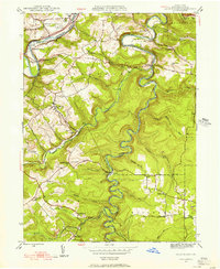
1944 · Glen Richey
USGS Topo · 1:24,000
Featured Places
- Bigler, Bradford Township
- Wallaceton, PA
- Decatur Township, PA
- Spring Valley, Boggs Township
- Morris Township, PA