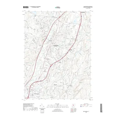
2018 Map of Wallingford
USGS Topo · Published 2018About this map
The Quinnipiac River corridor serves as the central artery for this late-2010s study of south-central Connecticut, connecting the dense urban layout of Wallingford Center with the northern reaches of North Haven. The landscape is a complex mix of industrial history and institutional growth, evidenced by the expansive Quinnipiac University North Haven Campus and the legacy of the Masonic Home. Local genealogical interest is high given the concentration of burial grounds, including the Holy Trinity Cem, In Memoriam Cem, and the historic Old Center Cem. To the east, the terrain rises toward Metacomet Ridge and Totoket Mtn, where water features like North Farms Reservoir and Simpson Pond punctuate the wooded uplands. Distinctive neighborhoods such as Yalesville, Quinnipiac, and Clintonville appear alongside vital transportation routes like Yale Ave and Postman Hwy.
Find a feature on this map
62 named features on this map. Tap any name to fly to it.
Don’t see what you’re looking for? This feature index may not catch every label — zoom into the map to look around manually.
Map Details
Editions of this 2018 Wallingford Map
This is the sole edition of this map. No revisions or reprints were ever made.
Other maps of this area

1892 · New Haven
USGS Topo · 1:62,500

1892 · Meriden
USGS Topo · 1:62,500

1893 · Guilford
USGS Topo · 1:62,500

1893 · Middletown
USGS Topo · 1:62,500

1893 · Meriden
USGS Topo · 1:62,500

1906 · Farmington
USGS Topo · 1:125,000

1921 · New Haven
USGS Topo · 1:62,500

1928 · Cromwell
USGS Topo · 1:24,000

1943 · Durham
USGS Topo · 1:25,000

1943 · New Haven
USGS Topo · 1:31,680