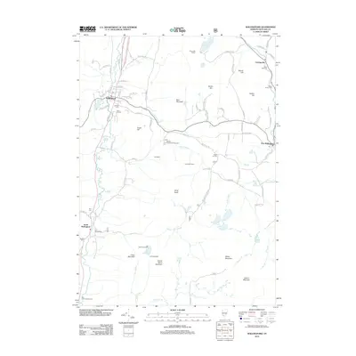
2012 Map of Wallingford
USGS Topo · Published 2012About this map
Otter Creek winds through the valley floor, anchoring a network of small settlements in this portion of Rutland County. The village of Wallingford serves as a primary hub, situated near Elfin Lake and the Catholic Cem, while South Wallingford and East Wallingford mark the southern and eastern extents of local habitation. The landscape is defined by its significant relief, including Bear Mountain, Green Mountain, and the stark presence of the Ice Beds and White Rocks. The distribution of burial grounds like Laurel Glen Cem and Pelsue Jarvary Cem reflects generations of family settlement in the hills. Remote shelters such as the Sunnyside Shelter and Greenwall Shelter dot the higher elevations, suggesting the importance of these mountain trails to the local geography. Significant water features like Spring Lake and Wallingford Pond occupy the upland basins between peaks like Granite Hill and Hateful Hill.
Find a feature on this map
80 named features on this map. Tap any name to fly to it.
Don’t see what you’re looking for? This feature index may not catch every label — zoom into the map to look around manually.
Map Details
Editions of this 2012 Wallingford Map
This is the sole edition of this map. No revisions or reprints were ever made.
Other maps of this area

1891 · Rutland
USGS Topo · 1:62,500

1893 · Wallingford
USGS Topo · 1:62,500

1893 · Rutland
USGS Topo · 1:62,500

1894 · Pawlet
USGS Topo · 1:62,500

1895 · Castleton
USGS Topo · 1:62,500

1897 · Pawlet
USGS Topo · 1:62,500

1897 · Castleton
USGS Topo · 1:62,500

1903 · Mettawee
USGS Topo · 1:125,000

1950 · Glens Falls
USGS Topo · 1:250,000

1955 · Wallingford
USGS Topo · 1:62,500