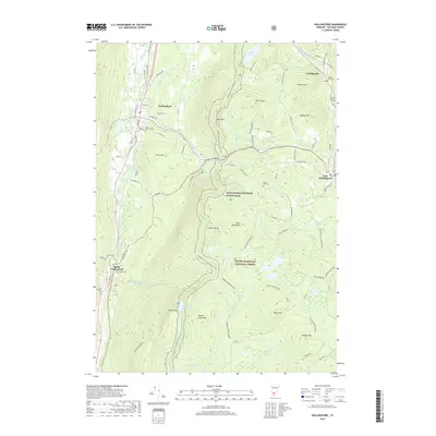
2018 Map of Wallingford
USGS Topo · Published 2018About this map
Otter Creek carves a central valley through this section of the Green Mountains, where the village of Wallingford serves as a hub for local commerce and historical sites. The landscape is defined by its verticality, rising from the creek banks to the heights of White Rocks and Bear Mtn. Settlement is concentrated along the river corridor and the eastern edge near Cuttingsville and East Wallingford, leaving much of the interior to the Green Mountain National Forest. A notable concentration of genealogy-rich sites includes several family and community burial grounds such as Laurel Glen Cem and Sugar Hill Cem. Hikers and conservationists will find the Appalachian National Scenic Trail winding through the high country, passing near the geologic interest of the Ice Beds and the high-elevation waters of Little Rock Pond.
Find a feature on this map
90 named features on this map. Tap any name to fly to it.
Don’t see what you’re looking for? This feature index may not catch every label — zoom into the map to look around manually.
Map Details
Editions of this 2018 Wallingford Map
This is the sole edition of this map. No revisions or reprints were ever made.
Other maps of this area

1891 · Rutland
USGS Topo · 1:62,500

1893 · Wallingford
USGS Topo · 1:62,500

1893 · Rutland
USGS Topo · 1:62,500

1894 · Pawlet
USGS Topo · 1:62,500

1895 · Castleton
USGS Topo · 1:62,500

1897 · Pawlet
USGS Topo · 1:62,500

1897 · Castleton
USGS Topo · 1:62,500

1903 · Mettawee
USGS Topo · 1:125,000

1950 · Glens Falls
USGS Topo · 1:250,000

1955 · Wallingford
USGS Topo · 1:62,500