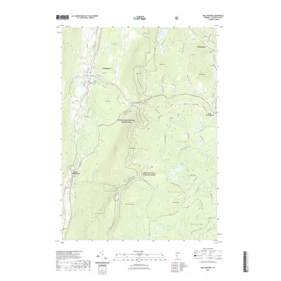
2021 Map of Wallingford
USGS Topo · Published 2021About this map
Wallingford occupies the valley of Otter Creek, serving as a central hub for this portion of the Green Mountains. The landscape is defined by the sharp rise of the terrain from the valley floor to prominent peaks like Bear Mtn and White Rocks. The Vermont Railway runs parallel to the creek, connecting the settlements of South Wallingford and Wallingford, while East Wallingford and Cuttingsville sit further east along the Mill River. This survey emphasizes the extensive network of recreational paths within the Green Mountain National Forest, including the Appalachian National Scenic Trail and specialized routes like the Homer Stone Snowmobile Trail. Numerous family and community burial grounds, such as Saint Patrick Cem and the Stafford Cem, provide a clear view of the area's genealogical history and early settlement patterns.
Find a feature on this map
90 named features on this map. Tap any name to fly to it.
Don’t see what you’re looking for? This feature index may not catch every label — zoom into the map to look around manually.
Map Details
Editions of this 2021 Wallingford Map
This is the sole edition of this map. No revisions or reprints were ever made.
Other maps of this area

1891 · Rutland
USGS Topo · 1:62,500

1893 · Wallingford
USGS Topo · 1:62,500

1893 · Rutland
USGS Topo · 1:62,500

1894 · Pawlet
USGS Topo · 1:62,500

1895 · Castleton
USGS Topo · 1:62,500

1897 · Pawlet
USGS Topo · 1:62,500

1897 · Castleton
USGS Topo · 1:62,500

1903 · Mettawee
USGS Topo · 1:125,000

1950 · Glens Falls
USGS Topo · 1:250,000

1955 · Wallingford
USGS Topo · 1:62,500