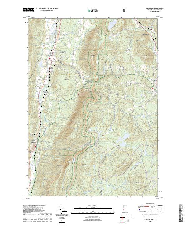
2024 Map of Wallingford
USGS Topo · Published 2024About this map
Otter Creek meanders through the western valley of this Rutland County landscape, anchoring a corridor defined by the Vermont Railway and settlements like Wallingford and South Wallingford. The terrain rises sharply to the east into the Green Mountain National Forest, where the Appalachian National Scenic Trail traverses ridges near White Rocks and Little Rock Pond. This contemporary survey illustrates the persistent rural character of the region, where historic family and community burial grounds such as Green Hill Cem and Pelsue-Jarvary Cem are preserved alongside modern recreation routes like the Homer Stone Snowmobile Trail. The map reveals a complex network of upland drainage, with Roaring Brook and Bully Brook carving through the high country between summits like Bear Mtn and Hateful Hill.
Find a feature on this map
94 named features on this map. Tap any name to fly to it.
Don’t see what you’re looking for? This feature index may not catch every label — zoom into the map to look around manually.
Map Details
Editions of this 2024 Wallingford Map
This is the sole edition of this map. No revisions or reprints were ever made.
Other maps of this area

1891 · Rutland
USGS Topo · 1:62,500

1893 · Wallingford
USGS Topo · 1:62,500

1893 · Rutland
USGS Topo · 1:62,500

1894 · Pawlet
USGS Topo · 1:62,500

1895 · Castleton
USGS Topo · 1:62,500

1897 · Pawlet
USGS Topo · 1:62,500

1897 · Castleton
USGS Topo · 1:62,500

1903 · Mettawee
USGS Topo · 1:125,000

1950 · Glens Falls
USGS Topo · 1:250,000

1955 · Wallingford
USGS Topo · 1:62,500