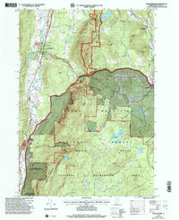
1997 Map of Wallingford
USGS Topo · Published 2000About this map
Wallingford sits at the western edge of this Vermont landscape, where the Otter Creek valley meets the rising peaks of the Green Mountain National Forest. The map documents a corridor of industry and recreation during the late 1990s, with the Clarendon and Pittsford RR and Ethan Allen Highway tracing the valley floor. To the south, a Marble Quarry near South Wallingford points to the region's geological resources, while the White Rocks National Recreation Area dominates the central terrain.
Find a feature on this map
44 named features on this map. Tap any name to fly to it.
Don’t see what you’re looking for? This feature index may not catch every label — zoom into the map to look around manually.
Map Details
Editions of this 1997 Wallingford Map
This is the sole edition of this map. No revisions or reprints were ever made.
Other maps of this area

1891 · Rutland
USGS Topo · 1:62,500

1893 · Wallingford
USGS Topo · 1:62,500

1893 · Rutland
USGS Topo · 1:62,500

1894 · Pawlet
USGS Topo · 1:62,500

1895 · Castleton
USGS Topo · 1:62,500

1897 · Pawlet
USGS Topo · 1:62,500

1897 · Castleton
USGS Topo · 1:62,500

1903 · Mettawee
USGS Topo · 1:125,000

1950 · Glens Falls
USGS Topo · 1:250,000

1955 · Wallingford
USGS Topo · 1:62,500