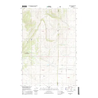
2017 Map of Wallrock
USGS Topo · Published 2017About this map
Wallrock is situated at the intersection of a complex drainage network where the Gallatin National Forest meets the open range of the high country. This landscape is defined by the branching waters of Muddy Cr, including its north, middle, and south forks, which carve through the terrain beneath Elkhorn Ridge. The area reflects a history of small-scale mountain navigation and rural land use, evidenced by the named gullies and basins that provided natural corridors for travel. Landmarks like Wallrock Basin and Coal Gulch suggest early exploration and the identification of local resources. A network of rural routes, including Big Muddy Creek Rd and Keister Hardy Rd, connects the scattered homesteads and ranches that follow the watercourses through the divide between Gallatin and Park counties.
Find a feature on this map
26 named features on this map. Tap any name to fly to it.
Don’t see what you’re looking for? This feature index may not catch every label — zoom into the map to look around manually.
Map Details
Editions of this 2017 Wallrock Map
This is the sole edition of this map. No revisions or reprints were ever made.
Other maps of this area

1886 · Little Belt Mts.
USGS Topo · 1:250,000

1891 · Livingston
USGS Topo · 1:250,000

1893 · Livingston
USGS Topo · 1:250,000

1894 · Little Belt Mts.
USGS Topo · 1:250,000

1897 · Little Belt Mts.
USGS Topo · 1:250,000

1898 · Little Belt Mts.
USGS Topo · 1:250,000

1902 · Little Belt Mts.
USGS Topo · 1:250,000

1947 · Bozeman
USGS Topo · 1:250,000

1948 · Bozeman
USGS Topo · 1:250,000

1948 · White Sulphur Springs
USGS Topo · 1:250,000