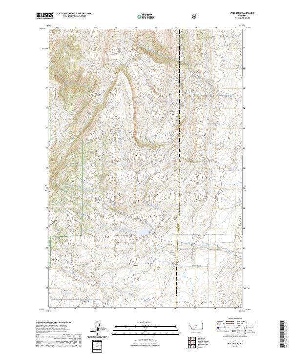
2024 Map of Wallrock
USGS Topo · Published 2024About this map
Sedan and the small settlement of Wallrock serve as the primary human touchpoints in this high-elevation landscape along the border of Gallatin and Park Counties. The terrain is defined by dramatic drainage systems, where the Middle Fork, South Fork, and North Fork Muddy Creek converge into a broader valley. To the west, the protected lands of the Gallatin National Forest rise toward Elkhorn Ridge, while the eastern portion is characterized by the expansive Wallrock Basin. The local road network, including Reservoir Rd and Big Muddy Creek Rd, follows the natural contours of the creeks, illustrating how topography has dictated rural development in this part of Montana. Water sources like Dry Creek and Rice Creek further detail the complex hydrology that supports the region's ranching and wilderness character.
Find a feature on this map
24 named features on this map. Tap any name to fly to it.
Don’t see what you’re looking for? This feature index may not catch every label — zoom into the map to look around manually.
Map Details
Editions of this 2024 Wallrock Map
This is the sole edition of this map. No revisions or reprints were ever made.
Other maps of this area

1886 · Little Belt Mts.
USGS Topo · 1:250,000

1891 · Livingston
USGS Topo · 1:250,000

1893 · Livingston
USGS Topo · 1:250,000

1894 · Little Belt Mts.
USGS Topo · 1:250,000

1897 · Little Belt Mts.
USGS Topo · 1:250,000

1898 · Little Belt Mts.
USGS Topo · 1:250,000

1902 · Little Belt Mts.
USGS Topo · 1:250,000

1947 · Bozeman
USGS Topo · 1:250,000

1948 · Bozeman
USGS Topo · 1:250,000

1948 · White Sulphur Springs
USGS Topo · 1:250,000