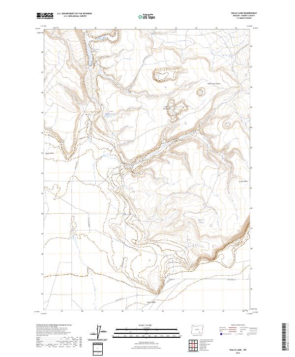
2024 Map of Walls Lake
USGS Topo · Published 2024About this map
Walls Lake Reservoir and the surrounding high desert terrain of Harney County define this interior drainage landscape. The area is characterized by scattered alkaline basins and seasonal water bodies, including Little Walls Lake and the La Voy Lakes tucked near the La Voy Tables. A network of isolated track roads such as Jack Mountain Rd and Clover Swail Rd provide the only access through these expansive sections, which transition from the floor of the Catlow Valley into higher relief features like Hole in the Ground and Walls Lake Canyon. The presence of Waterhole Canyon and Sand Hollow suggests the critical importance of intermittent water sources in this arid environment, where topographic depressions often serve as the primary landmarks for navigation and land management.
Find a feature on this map
17 named features on this map. Tap any name to fly to it.
Don’t see what you’re looking for? This feature index may not catch every label — zoom into the map to look around manually.
Map Details
Editions of this 2024 Walls Lake Map
This is the sole edition of this map. No revisions or reprints were ever made.
Other maps of this area

1955 · Adel
USGS Topo · 1:250,000

1957 · Adel
USGS Topo · 1:250,000

1958 · Adel
USGS Topo · 1:250,000

1962 · Adel
USGS Topo · 1:250,000

1967 · Roaring Springs
USGS Topo · 1:24,000

1967 · Frenchglen
USGS Topo · 1:24,000
1967 · Irish Lake
USGS Topo · 1:24,000

1971 · Duhaime Flat East
USGS Topo · 1:24,000
1971 · Keg Sprs Valley East
USGS Topo · 1:24,000

1971 · Butler Hill
USGS Topo · 1:24,000