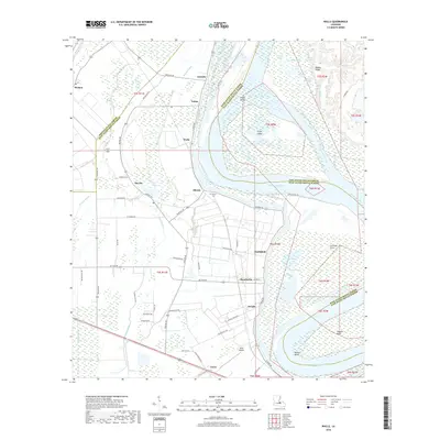
2018 Map of Walls
USGS Topo · Published 2018About this map
The Mississippi River defines the landscape of this Louisiana quadrangle, winding through a complex network of chutes and bends including Mallet Bend and Profit Island Chute. Along the western bank, the settlements of Chamberlin, Smithfield, and Devalls are situated amidst a patchwork of agricultural land and bayous. The map highlights the significant presence of water features like Tiger Bayou and Stumpy Bayou, which drain the low-lying terrain. To the north, the small community of Arbroth and the Alford Cem provide specific points for genealogical research. The presence of Profit Island within the river channel suggests the dynamic nature of the waterway, while the Omni Airport near Carey indicates more modern infrastructure development in West Baton Rouge Parish.
Find a feature on this map
74 named features on this map. Tap any name to fly to it.
Don’t see what you’re looking for? This feature index may not catch every label — zoom into the map to look around manually.
Map Details
Editions of this 2018 Walls Map
This is the sole edition of this map. No revisions or reprints were ever made.
Other maps of this area

1906 · Bayou Sara
USGS Topo · 1:125,000

1908 · Baton Rouge
USGS Topo · 1:62,500

1939 · Zachary
USGS Topo · 1:62,500

1939 · Baton Rouge
USGS Topo · 1:62,500

1940 · Grosse Tete
USGS Topo · 1:62,500

1953 · Baton Rouge West
USGS Topo · 1:24,000

1953 · Lobdell
USGS Topo · 1:24,000

1953 · New Roads
USGS Topo · 1:24,000

1954 · Zachary
USGS Topo · 1:24,000

1954 · Port Hudson
USGS Topo · 1:24,000