
1964 Map of Wallula
USGS Topo · Published 1965About this map
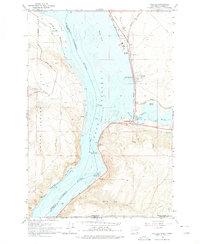
The Columbia River and its confluence with the Walla Walla River dominate this mid-century landscape at the border of Washington and Oregon. The area is defined by a complex network of transportation and industry, with the Northern Pacific, Spokane Portland and Seattle, and Union Pacific railroads converging near settlements like Attalia and Wallula Junction. The rise of Wallula Lake behind the Wallula Gap has reshaped the shoreline, which is dotted with industrial and scientific sites including a paper mill, grain elevators, and the Wind and Wave Recording Station.
Find a feature on this map
39 named features on this map. Tap any name to fly to it.
Don’t see what you’re looking for? This feature index may not catch every label — zoom into the map to look around manually.
Map Details
Editions of this 1964 Wallula Map
2 editions found
Other maps of this area

1908 · Umatilla
USGS Topo · 1:125,000

1915 · Wallulah
USGS Topo · 1:96,000

1917 · Pasco
USGS Topo · 1:125,000

1918 · Wallula
USGS Topo · 1:125,000

1935 · Pendleton
USGS Topo · 1:125,000

1953 · Pendleton
USGS Topo · 1:250,000

1953 · Walla Walla
USGS Topo · 1:250,000

1956 · Pendleton
USGS Topo · 1:250,000

1958 · Walla Walla
USGS Topo · 1:250,000

1962 · Juniper
USGS Topo · 1:24,000