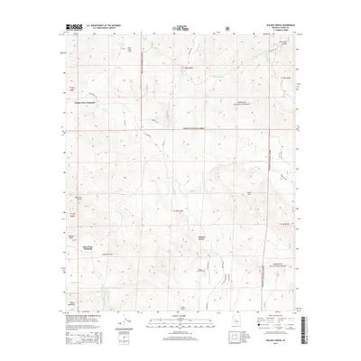
2014 Map of Walnut Grove
USGS Topo · Published 2014About this map
Walnut Grove serves as the focal point of this arid Yavapai County landscape, situated along the winding course of the Hassayampa River. The 2014 survey reveals a territory defined by deep gulches and significant elevation changes, ranging from the southern peaks of the Weaver Mountains to the prominence of Black Mtn in the east. Local history and ranching heritage are evident in the naming of functional landmarks like the Walker Place Windmill and Rush Place Windmill, while the Walnut Grove Cem provides a vital link for genealogists researching early settlement in the area. Water management is a primary theme of the terrain, with numerous tanks such as Carter Tank and Mesa Tank distributed across the drainage basins of Milk Cr and French Gulch. Much of the northern and eastern sections are contained within the Prescott National Forest, where a network of trails and roads like S Wagoner Rd provides access to remote canyons.
Find a feature on this map
44 named features on this map. Tap any name to fly to it.
Don’t see what you’re looking for? This feature index may not catch every label — zoom into the map to look around manually.
Map Details
Editions of this 2014 Walnut Grove Map
This is the sole edition of this map. No revisions or reprints were ever made.
Other maps of this area

1887 · Prescott
USGS Topo · 1:250,000

1892 · Prescott
USGS Topo · 1:250,000

1903 · Bradshaw Mountains
USGS Topo · 1:125,000

1903 · Congress
USGS Topo · 1:125,000

1904 · Congress
USGS Topo · 1:125,000

1947 · Crown King
USGS Topo · 1:62,500

1947 · Mt. Union
USGS Topo · 1:62,500

1947 · Kirkland
USGS Topo · 1:62,500

1947 · Wagoner
USGS Topo · 1:62,500

1948 · Crown King
USGS Topo · 1:63,360