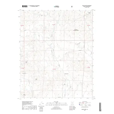
2018 Map of Walnut Grove
USGS Topo · Published 2018About this map
Walnut Grove serves as the focal point for this Yavapai County terrain, situated where the Hassayampa River flows south through a series of rugged gulches and ridges. The settlement is anchored by the Walnut Grove Cem, providing a significant point of interest for genealogists and local historians tracing families in this part of Arizona. The landscape is defined by the high elevations of the Weaver Mountains to the southwest and the eastern edges of the Prescott National Forest, where labels like Fire Clay Hill and Fire Clay Tank suggest a history of local mineral exploration or geological interest.
Find a feature on this map
43 named features on this map. Tap any name to fly to it.
Don’t see what you’re looking for? This feature index may not catch every label — zoom into the map to look around manually.
Map Details
Editions of this 2018 Walnut Grove Map
This is the sole edition of this map. No revisions or reprints were ever made.
Other maps of this area

1887 · Prescott
USGS Topo · 1:250,000

1892 · Prescott
USGS Topo · 1:250,000

1903 · Bradshaw Mountains
USGS Topo · 1:125,000

1903 · Congress
USGS Topo · 1:125,000

1904 · Congress
USGS Topo · 1:125,000

1947 · Crown King
USGS Topo · 1:62,500

1947 · Mt. Union
USGS Topo · 1:62,500

1947 · Kirkland
USGS Topo · 1:62,500

1947 · Wagoner
USGS Topo · 1:62,500

1948 · Crown King
USGS Topo · 1:63,360