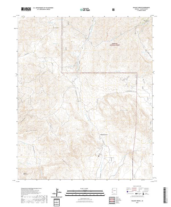
2021 Map of Walnut Grove
USGS Topo · Published 2021About this map
The Hassayampa River flows southward through this high-desert portion of Yavapai County, carving a path between the eastern foothills of the Weaver Mountains and the rising slopes of the Prescott National Forest. The community of Walnut Grove remains a central point of interest, established near the river banks and serving as a historical touchstone for the surrounding ranching and mining country. The landscape is defined by deep drainages and ridges, including Mahoney Ridge and Black Mtn, where numerous gulches such as French Gulch and Placerita Gulch once drew prospectors seeking mineral wealth. Local transit and land use are etched into the terrain by named routes like W Wagoner Rd and White Head Ranch Rd, which connect remote water sources like Moores Spring and Collins Spring to the main settlement and its nearby Walnut Grove Cem.
Find a feature on this map
44 named features on this map. Tap any name to fly to it.
Don’t see what you’re looking for? This feature index may not catch every label — zoom into the map to look around manually.
Map Details
Editions of this 2021 Walnut Grove Map
This is the sole edition of this map. No revisions or reprints were ever made.
Other maps of this area

1887 · Prescott
USGS Topo · 1:250,000

1892 · Prescott
USGS Topo · 1:250,000

1903 · Bradshaw Mountains
USGS Topo · 1:125,000

1903 · Congress
USGS Topo · 1:125,000

1904 · Congress
USGS Topo · 1:125,000

1947 · Crown King
USGS Topo · 1:62,500

1947 · Mt. Union
USGS Topo · 1:62,500

1947 · Kirkland
USGS Topo · 1:62,500

1947 · Wagoner
USGS Topo · 1:62,500

1948 · Crown King
USGS Topo · 1:63,360