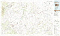
1982 Map of Walsenburg
USGS Topo · Published 1982About this map
Walsenburg serves as a central hub on this 1982 map, situated at the base of the Wet Mountains where the high plains meet the eastern slopes of the Rockies. The transition from industrial mining activities to vast rangeland is evident through the placement of the Pacific Mine and Globe Mine near the settlements of Pictou and Maitland Arroyo. The landscape is etched by a complex drainage system, including the Huerfano River, Cucharas River, and Apishapa River, which have carved canyons like Canyon de Agua and Dripping Springs Canyon. Transportation history is well-represented, showing the intersection of the Santa Fe Trail with modern corridors like U S Highway 85 87 and the Denver and Rio Grande Western Railroad. Further east, the map reveals the open expanses of the Apishapa State Wildlife Area and the Tyrone Flats, highlighting the sparsely populated terrain of the High Plains.
Find a feature on this map
116 named features on this map. Tap any name to fly to it.
Don’t see what you’re looking for? This feature index may not catch every label — zoom into the map to look around manually.
Map Details
Editions of this 1982 Walsenburg Map
This is the sole edition of this map. No revisions or reprints were ever made.
Other maps of this area

1889 · Canon City
USGS Topo · 1:125,000

1889 · Huerfano Park
USGS Topo · 1:125,000

1891 · Walsenburg
USGS Topo · 1:125,000

1891 · Catlin
USGS Topo · 1:125,000

1891 · Pueblo
USGS Topo · 1:125,000

1891 · Spanish Peaks
USGS Topo · 1:125,000

1891 · Timpas
USGS Topo · 1:125,000

1891 · Nepesta
USGS Topo · 1:125,000

1891 · Apishapa
USGS Topo · 1:125,000

1891 · Mesa De Maya
USGS Topo · 1:125,000