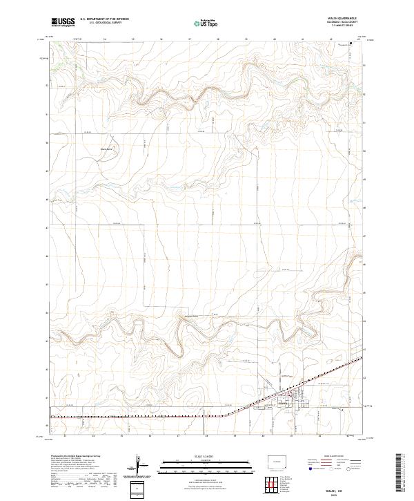
2022 Map of Walsh
USGS Topo · Published 2022About this map
Walsh occupies the southern reaches of this Baca County survey, where the town grid is well-established along Santa Fe St and W Pine St. The surrounding high plains landscape is defined by the winding paths of seasonal drainages, including the meandering Bear Creek and Antelope Cr, which carve subtle topography through the range. To the north, the terrain is punctuated by distinctive geological landmarks such as Black Butte and Buffalo Point, providing orientation across the vast township divisions of the High Plains.
Find a feature on this map
49 named features on this map. Tap any name to fly to it.
Don’t see what you’re looking for? This feature index may not catch every label — zoom into the map to look around manually.
Map Details
Editions of this 2022 Walsh Map
This is the sole edition of this map. No revisions or reprints were ever made.
Other maps of this area

1891 · Albany
USGS Topo · 1:125,000

1892 · Vilas
USGS Topo · 1:125,000

1893 · Albany
USGS Topo · 1:125,000

1955 · La Junta
USGS Topo · 1:250,000

1958 · La Junta
USGS Topo · 1:250,000

1968 · La Junta
USGS Topo · 1:250,000

1971 · Two Buttes SE
USGS Topo · 1:24,000
1971 · Lycan
USGS Topo · 1:24,000
1971 · Two Buttes
USGS Topo · 1:24,000

1978 · Walsh SE
USGS Topo · 1:24,000