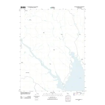
2012 Map of Walter Springs
USGS Topo · Published 2012About this map
Walter Springs and the northern reaches of Lake Berryessa define this Napa County landscape during the early 21st century. The map centers on the winding course of Putah Cr as it feeds into the massive reservoir, surrounded by a complex system of drainages including Eticuera Cr, Pope Cr, and Adams Cr. The terrain is marked by significant elevations like Turner Mountain and Barton Hill, alongside notable depressions and clearings such as Cedar Valley and Gibson Flat.
Find a feature on this map
25 named features on this map. Tap any name to fly to it.
Don’t see what you’re looking for? This feature index may not catch every label — zoom into the map to look around manually.
Map Details
Editions of this 2012 Walter Springs Map
This is the sole edition of this map. No revisions or reprints were ever made.
Other maps of this area

1924 · Capay
USGS Topo · 1:62,500

1942 · St. Helena
USGS Topo · 1:62,500

1943 · Morgan Valley
USGS Topo · 1:62,500

1943 · Capay
USGS Topo · 1:62,500

1944 · Morgan Valley
USGS Topo · 1:62,500

1945 · Capay
USGS Topo · 1:62,500

1945 · Rumsey
USGS Topo · 1:62,500

1945 · St. Helena
USGS Topo · 1:62,500

1947 · Santa Rosa
USGS Topo · 1:250,000

1949 · Santa Rosa
USGS Topo · 1:250,000