
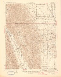
1945 Map of Rumsey
USGS Topo · Published 1945About this map
Canada De Capay forms the defining valley of this mid-1940s landscape, where Cache Creek winds past the small settlements of Rumsey and Guinda. The topography transitions sharply from the alluvial flats near Harrington to the uplifted terrain of Blue Ridge and landmarks like Bald Mtn and Indian Mike Pt. Transport and infrastructure of the era are clearly marked, including the Southern Pacific railroad line and an Airway Beacon positioned to guide mid-century pilots over the coastal ranges. Local educational history is anchored by the Wildwood Sch and Cañon Sch, while the drainage network of Buckeye Creek and Petroleum Creek illustrates the complex watershed feeding the central valley. The map captures a moment when rural life centered on these canyon floor communities before modern development shifted the regional focus.
Find a feature on this map
33 named features on this map. Tap any name to fly to it.
Don’t see what you’re looking for? This feature index may not catch every label — zoom into the map to look around manually.
Map Details
Editions of this 1945 Rumsey Map
2 editions found
Other maps of this area

1888 · Marysville
USGS Topo · 1:125,000

1891 · Marysville
USGS Topo · 1:125,000

1894 · Marysville
USGS Topo · 1:125,000

1895 · Marysville
USGS Topo · 1:125,000

1905 · Harrington
USGS Topo · 1:24,000

1905 · Esparto
USGS Topo · 1:24,000

1907 · Dunnigan
USGS Topo · 1:62,500

1907 · Colusa
USGS Topo · 1:62,500

1907 · Woodland
USGS Topo · 1:62,500

1911 · Grimes
USGS Topo · 1:31,680