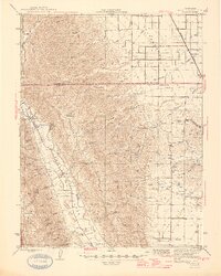
1945 Map of Rumsey
USGS Topo · Published 1945About this map
Cañada de Capay forms the agricultural heart of this mid-1940s landscape, where the Southern Pacific rail line terminates near Rumsey. The settlement pattern follows the fertile valley floor along Cache Creek, anchored by the small communities of Guinda and the rural education hubs at Cañon Sch and Wildwood Sch. Beyond the valley floor, the terrain is defined by a dense network of named canyons including Murphy Canyon, Mushroom Canyon, and Sulphur Canyon, suggesting a rugged transition into the foothills. The presence of an Airway Beacon and Petroleum Creek points to the early modern infrastructure and resource extraction interests present in the region during the World War II era. Genealogists may find value in the precise location of the Cem near the northern end of the valley, while the mapping of family-named flats like Murphy Flat and Casey Flat provides a window into local land ownership.
Find a feature on this map
48 named features on this map. Tap any name to fly to it.
Don’t see what you’re looking for? This feature index may not catch every label — zoom into the map to look around manually.
Map Details
Editions of this 1945 Rumsey Map
2 editions found

Other maps of this area

1888 · Marysville
USGS Topo · 1:125,000

1891 · Marysville
USGS Topo · 1:125,000

1894 · Marysville
USGS Topo · 1:125,000

1895 · Marysville
USGS Topo · 1:125,000

1905 · Harrington
USGS Topo · 1:24,000

1905 · Esparto
USGS Topo · 1:24,000

1907 · Dunnigan
USGS Topo · 1:62,500

1907 · Colusa
USGS Topo · 1:62,500

1907 · Woodland
USGS Topo · 1:62,500

1911 · Grimes
USGS Topo · 1:31,680