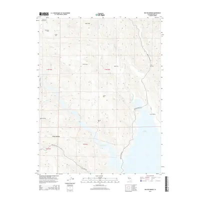
2015 Map of Walter Springs
USGS Topo · Published 2015About this map
Walter Springs stands at the heart of this Napa County landscape, situated at the junction of several prominent drainages including Pope Cr and Maxwell Cr. The northern reaches are defined by a complex series of valleys and ridges, most notably the intriguingly named Mysterious Valley and its corresponding Mysterious Valley Airport. The eastern boundary of the sheet is dominated by the northern fingers of Lake Berryessa, where the Eticuera Creek watershed meets the reservoir. Settlement patterns are concentrated along narrow road corridors such as Pope Canyon Rd and Berryessa Knoxville Rd, which navigate the steep topography between Turner Mtn and the various flats like Moore Flat and Gibson Flat. The map documents a rugged interior terrain characterized by seasonal creeks such as Adams Cr and Dyer Cr that feed into the larger water systems of the region.
Find a feature on this map
32 named features on this map. Tap any name to fly to it.
Don’t see what you’re looking for? This feature index may not catch every label — zoom into the map to look around manually.
Map Details
Editions of this 2015 Walter Springs Map
This is the sole edition of this map. No revisions or reprints were ever made.
Other maps of this area

1924 · Capay
USGS Topo · 1:62,500

1942 · St. Helena
USGS Topo · 1:62,500

1943 · Morgan Valley
USGS Topo · 1:62,500

1943 · Capay
USGS Topo · 1:62,500

1944 · Morgan Valley
USGS Topo · 1:62,500

1945 · Capay
USGS Topo · 1:62,500

1945 · Rumsey
USGS Topo · 1:62,500

1945 · St. Helena
USGS Topo · 1:62,500

1947 · Santa Rosa
USGS Topo · 1:250,000

1949 · Santa Rosa
USGS Topo · 1:250,000