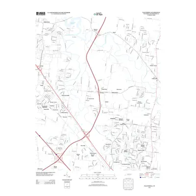
2013 Map of Walterhill
USGS Topo · Published 2013About this map
The W Fork Stones River and E Fork Stones River converge near the northern edge of this quadrangle, forming a riparian landscape that gives way to the expansive J Percy Priest Reservoir. This area of Rutherford County displays a transition from rural crossroads like Hickory Grove and Mona to more densely clustered subdivisions such as Battlefield Meadows, Creekmont, and Cherry Lane Acres. Notable hydrologic features like Sulphur Spring and Sinking Cr punctuate the limestone-underlain terrain, while the community of Walterhill stands at a prominent bend in the East Fork. The map shows the growth of Murfreesboro's periphery, where modern residential developments like Yorktown and Fairmont sit alongside established locations such as Cooks Corner and Florence.
Find a feature on this map
349 named features on this map. Tap any name to fly to it.
Don’t see what you’re looking for? This feature index may not catch every label — zoom into the map to look around manually.
Map Details
Editions of this 2013 Walterhill Map
This is the sole edition of this map. No revisions or reprints were ever made.
Other maps of this area

1903 · Nashville
USGS Topo · 1:125,000

1916 · Murfreesboro
USGS Topo · 1:62,500

1932 · Hermitage
USGS Topo · 1:62,500

1942 · Lebanon
USGS Topo · 1:100,000

1950 · Walterhill
USGS Topo · 1:24,000

1950 · Murfreesboro
USGS Topo · 1:24,000

1952 · La Vergne
USGS Topo · 1:24,000

1956 · Vine
USGS Topo · 1:24,000

1956 · Dillton
USGS Topo · 1:24,000

1956 · Gladeville
USGS Topo · 1:24,000