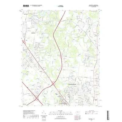
2019 Map of Walterhill
USGS Topo · Published 2019About this map
The Stones River National Battlefield preserves the site of a pivotal Civil War conflict, situated where the West Fork Stones River and Overall Creek intersect north of Murfreesboro. This landscape is deeply tied to its 19th-century history, evidenced by the high concentration of family burial grounds such as Templeton Grove Cem, Neal-Wade Cem, and McFadden Cem. The suburban growth of Smyrna and the northern reaches of the county seat are countered by established rural communities like Leanna, Florence, and Mona. Aviation history and utility are represented by the presence of both the Stones River Airport and the Murfreesboro Municipal Airport. The local road network, including W Jefferson Pike and Lebanon Pike, follows traditional routes through a terrain shaped by the winding forks of the Stones River, documenting the area's transition from a significant battlefield and agricultural hub into a modern residential corridor.
Find a feature on this map
79 named features on this map. Tap any name to fly to it.
Don’t see what you’re looking for? This feature index may not catch every label — zoom into the map to look around manually.
Map Details
Editions of this 2019 Walterhill Map
This is the sole edition of this map. No revisions or reprints were ever made.
Other maps of this area

1903 · Nashville
USGS Topo · 1:125,000

1916 · Murfreesboro
USGS Topo · 1:62,500

1932 · Hermitage
USGS Topo · 1:62,500

1942 · Lebanon
USGS Topo · 1:100,000

1950 · Walterhill
USGS Topo · 1:24,000

1950 · Murfreesboro
USGS Topo · 1:24,000

1952 · La Vergne
USGS Topo · 1:24,000

1956 · Vine
USGS Topo · 1:24,000

1956 · Dillton
USGS Topo · 1:24,000

1956 · Gladeville
USGS Topo · 1:24,000