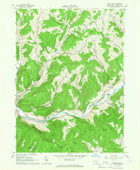
1965 Map of Walton East
USGS Topo · Published 1966About this map
The West Branch Delaware River winds through this Catskill mountain landscape, defining the valley floors where the village of Walton and the hamlet of Hawleys are established. In the mid-1960s, this area reflects a balance between riverside settlement and extensive conservation, with significant portions of the terrain dedicated to the Bear Spring Mountain Game Management Area and the State Forest Preserve. The map illustrates a network of hollows—such as Chambers Hollow and Curtis Hollow—that channel numerous tributaries like East Brook and Mallory Brook toward the main river. Notable landmarks of the era include the Radio Tower (WDLA) on Bear Spring Mountain and local recreational sites like Bassett Park and a riverside Golf Course. For those studying local land use, the map details the transition from the river valley to higher elevations like Colchester Mountain and Dunk Hill.
Find a feature on this map
43 named features on this map. Tap any name to fly to it.
Don’t see what you’re looking for? This feature index may not catch every label — zoom into the map to look around manually.
Map Details
Editions of this 1965 Walton East Map
2 editions found
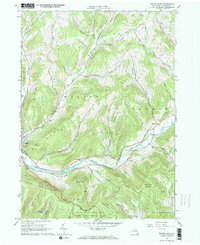
Other maps of this area

1909 · Delhi
USGS Topo · 1:62,500

1911 · Delhi
USGS Topo · 1:62,500

1915 · Oneonta
USGS Topo · 1:62,500

1918 · Oneonta
USGS Topo · 1:62,500

1922 · Andes
USGS Topo · 1:62,500

1923 · Walton
USGS Topo · 1:48,000

1924 · Andes
USGS Topo · 1:62,500

1925 · Walton
USGS Topo · 1:62,500

1943 · Delhi
USGS Topo · 1:24,000

1943 · Franklin
USGS Topo · 1:24,000