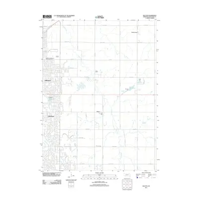
2011 Map of Walton
USGS Topo · Published 2011About this map
The eastern expansion of Lincoln meets the agricultural landscape of Lancaster County in this study of the suburban-rural fringe. Residential developments like Wedgewood Lake and established institutions such as the University of Nebraska Experimental Farm contrast with the open fields of Prairie Home and the village of Walton. The terrain is defined by the winding course of Stevens Creek, which feeds into small impoundments like Monahan Reservoir and Jones Reservoir. This drainage network is a primary factor in the local topography, with Deadmans Run and Antelope Creek carving through the western sections of the map. Traces of early settlement remain visible at Fairview Cemetery and Schultz Cemetery, while the presence of Pester Airport and the Walton Post Office highlight the infrastructure supporting these outlying communities.
Find a feature on this map
56 named features on this map. Tap any name to fly to it.
Don’t see what you’re looking for? This feature index may not catch every label — zoom into the map to look around manually.
Map Details
Editions of this 2011 Walton Map
This is the sole edition of this map. No revisions or reprints were ever made.
Other maps of this area

1897 · Lincoln
USGS Topo · 1:125,000

1903 · Weeping Water
USGS Topo · 1:125,000

1929 · Weeping Water
USGS Topo · 1:125,000

1955 · Lincoln
USGS Topo · 1:250,000

1957 · Lincoln
USGS Topo · 1:250,000

1958 · Lincoln
USGS Topo · 1:250,000

1964 · Waverly
USGS Topo · 1:24,000

1964 · Roca
USGS Topo · 1:24,000

1964 · Davey
USGS Topo · 1:24,000

1964 · Walton
USGS Topo · 1:24,000