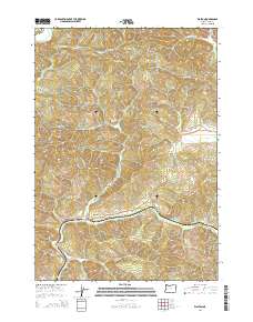
2014 Map of Walton
USGS Topo · Published 2014About this map
Walton sits at the convergence of mountain drainages in western Lane County, serving as a hub for the surrounding timberlands and valleys. The settlement is positioned near the junction of Wildcat Cr and Chickahominy Cr, with Or-126 providing the primary corridor through this section of the Coast Range. High points such as Iron Mtn, Nelson Mtn, and Badger Mtn frame a landscape defined by deep creek beds and ridgelines.
Find a feature on this map
51 named features on this map. Tap any name to fly to it.
Don’t see what you’re looking for? This feature index may not catch every label — zoom into the map to look around manually.
Map Details
Editions of this 2014 Walton Map
This is the sole edition of this map. No revisions or reprints were ever made.
Other maps of this area

1909 · Elmira
USGS Topo · 1:62,500

1922 · Elmira
USGS Topo · 1:62,500

1941 · Blachly
USGS Topo · 1:62,500

1942 · Elmira
USGS Topo · 1:62,500

1942 · Blachly
USGS Topo · 1:62,500

1942 · Crow
USGS Topo · 1:62,500

1942 · Roman Nose Mtn
USGS Topo · 1:62,500

1945 · Crow
USGS Topo · 1:62,500

1945 · Roman Nose Mtn
USGS Topo · 1:62,500

1953 · Salem
USGS Topo · 1:250,000