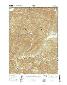
2017 Map of Walton
USGS Topo · Published 2017About this map
Walton sits at the confluence of several vital waterways in this part of Lane County, where the southern drainage of Wildcat Cr meets the upper reaches of Pataha Cr and Walker Cr. The landscape is defined by its steep elevations and timber-ready terrain, dominated by significant peaks such as Iron Mtn, Nelson Mtn, and Badger Mtn. A complex network of logging and access roads, such as Walker Point Rd and Nelson Mountain Rd, weave through the narrow valleys and across high points like Cougar Pass. Genealogists will find local history preserved at the Chickahominy Cem and Walton Cem, which mark the early footprint of this rural community. The concentration of smaller tributaries like Jack Hays Cr, January Cr, and Potterf Cr illustrates a watershed system that shaped the region's early development and logging routes.
Find a feature on this map
51 named features on this map. Tap any name to fly to it.
Don’t see what you’re looking for? This feature index may not catch every label — zoom into the map to look around manually.
Map Details
Editions of this 2017 Walton Map
This is the sole edition of this map. No revisions or reprints were ever made.
Other maps of this area

1909 · Elmira
USGS Topo · 1:62,500

1922 · Elmira
USGS Topo · 1:62,500

1941 · Blachly
USGS Topo · 1:62,500

1942 · Elmira
USGS Topo · 1:62,500

1942 · Blachly
USGS Topo · 1:62,500

1942 · Crow
USGS Topo · 1:62,500

1942 · Roman Nose Mtn
USGS Topo · 1:62,500

1945 · Crow
USGS Topo · 1:62,500

1945 · Roman Nose Mtn
USGS Topo · 1:62,500

1953 · Salem
USGS Topo · 1:250,000