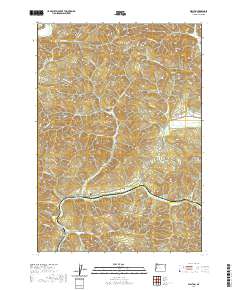
2020 Map of Walton
USGS Topo · Published 2020About this map
The community of Walton sits at the base of the Coast Range foothills, where the confluence of several vital watercourses defines the local topography. This 2020 survey documents the area's transition from high ridges like Nelson Mtn and Iron Mtn to the narrow valley floors. The presence of the Walton PO and nearby Walton Cem marks the enduring social center of this rural Oregon landscape, while the Chickahominy Cem to the north reflects the distributed nature of early hillside settlements.
Find a feature on this map
53 named features on this map. Tap any name to fly to it.
Don’t see what you’re looking for? This feature index may not catch every label — zoom into the map to look around manually.
Map Details
Editions of this 2020 Walton Map
This is the sole edition of this map. No revisions or reprints were ever made.
Other maps of this area

1909 · Elmira
USGS Topo · 1:62,500

1922 · Elmira
USGS Topo · 1:62,500

1941 · Blachly
USGS Topo · 1:62,500

1942 · Elmira
USGS Topo · 1:62,500

1942 · Blachly
USGS Topo · 1:62,500

1942 · Crow
USGS Topo · 1:62,500

1942 · Roman Nose Mtn
USGS Topo · 1:62,500

1945 · Crow
USGS Topo · 1:62,500

1945 · Roman Nose Mtn
USGS Topo · 1:62,500

1953 · Salem
USGS Topo · 1:250,000