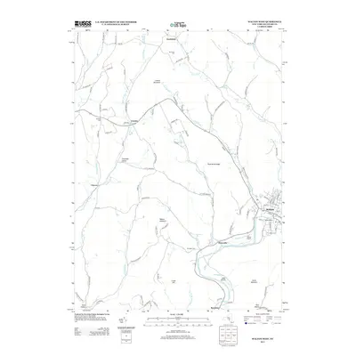
2013 Map of Walton West
USGS Topo · Published 2013About this map
The W Br Delaware River carves through the southern landscape of this 2013 survey, anchoring the riverside settlements of Walton and Beerston. This region is defined by its deep valley networks, where narrow roads follow the courses of Third Brook, Loomis Brook, and Pines Brook. Higher elevations are marked by prominent summits like Walton Mountain and Loomis Mountain, creating a rugged terrain that influenced the dispersed settlement patterns of rural hamlets like Northfield and Loomis. Significant local landmarks provide insight into the community's agricultural and civil heritage, including the Walton Grange and several historic burial grounds such as Walton Cem and Northfield Cem. The concentration of infrastructure near the river, including the Walton Airport, highlights the valley's role as a primary corridor for transportation and commerce in Delaware County.
Find a feature on this map
104 named features on this map. Tap any name to fly to it.
Don’t see what you’re looking for? This feature index may not catch every label — zoom into the map to look around manually.
Map Details
Editions of this 2013 Walton West Map
This is the sole edition of this map. No revisions or reprints were ever made.
Other maps of this area

1915 · Oneonta
USGS Topo · 1:62,500

1915 · Unadilla
USGS Topo · 1:62,500

1918 · Unadilla
USGS Topo · 1:62,500

1918 · Oneonta
USGS Topo · 1:62,500

1923 · Walton
USGS Topo · 1:48,000

1924 · Deposit
USGS Topo · 1:62,500

1925 · Walton
USGS Topo · 1:62,500

1926 · Deposit
USGS Topo · 1:62,500

1943 · Franklin
USGS Topo · 1:24,000
1943 · Unadilla
USGS Topo · 1:24,000