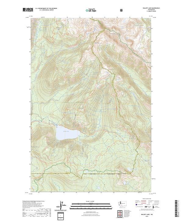
2023 Map of Walupt Lake
USGS Topo · Published 2023About this map
Walupt Lake sits at the heart of this high-elevation wilderness, where the boundaries of Gifford Pinchot National Forest and the Goat Rocks Wilderness meet. The landscape is defined by the sharp transition between the Cispus River drainage and the Klickitat River headwaters, bridged by the high-altitude Cispus Pass. This area serves as a critical junction for major alpine routes, most notably the Pacific Crest National Scenic Trail, which traverses the ridge lines past Sheep Lake and Snowgrass Flat.
Find a feature on this map
37 named features on this map. Tap any name to fly to it.
Don’t see what you’re looking for? This feature index may not catch every label — zoom into the map to look around manually.
Map Details
Editions of this 2023 Walupt Lake Map
This is the sole edition of this map. No revisions or reprints were ever made.
Other maps of this area

1902 · Mount Aix
USGS Topo · 1:125,000

1904 · Mt Aix
USGS Topo · 1:125,000

1904 · Mount Adams
USGS Topo · 1:125,000

1907 · Mount Adams
USGS Topo · 1:125,000

1924 · Mt Rainier
USGS Topo · 1:96,000

1926 · Steamboat Mtn
USGS Topo · 1:125,000

1928 · Mt Rainier
USGS Topo · 1:125,000

1931 · Steamboat Mtn
USGS Topo · 1:125,000

1950 · Yakima
USGS Topo · 1:250,000

1958 · Yakima
USGS Topo · 1:250,000