
1943 Map of Wampee
USGS Topo · Published 1947About this map
The coastal landscapes of Horry County are defined here by a mix of early-century maritime industry and wartime military installations. Inland from the Atlantic Ocean, the Intracostal Waterway carves through the terrain, separating the mainland from Little River Neck. The 1940s landscape is heavily marked by the mobilization for World War II, featuring the expansive U. S. Army Bombing Range and the Windy Hill Antiaircraft Camp positioned near the shoreline.
Find a feature on this map
42 named features on this map. Tap any name to fly to it.
Don’t see what you’re looking for? This feature index may not catch every label — zoom into the map to look around manually.
Map Details
Editions of this 1943 Wampee Map
This is the sole edition of this map. No revisions or reprints were ever made.
Other maps of this area

1937 · Myrtle Beach
USGS Topo · 1:48,000

1937 · Nixonville
USGS Topo · 1:48,000

1940 · Myrtle Beach
USGS Topo · 1:62,500

1942 · Nixonville
USGS Topo · 1:62,500

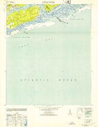
1943 · Little River
USGS Topo · 1:31,680

1943 · Calabash
USGS Topo · 1:31,680

1944 · Longs
USGS Topo · 1:31,680

1949 · Georgetown
USGS Topo · 1:250,000
1953 · Little River
USGS Topo · 1:24,000

1953 · Longs
USGS Topo · 1:24,000
Featured Places
- North Myrtle Beach, SC
- Briarcliffe Acres, SC
- Atlantic Beach, SC
- Windy Hill Beach, North Myrtle Beach
- Cherry Grove Beach, North Myrtle Beach