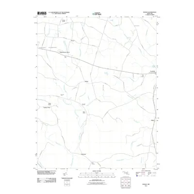
2011 Map of Wango
USGS Topo · Published 2011About this map
Nassauango Creek and its many tributaries, including the Widow Hawkins Branch and Beaverdam Creek, dominate the low-lying interior of this Wicomico County landscape. Small rural communities and crossroads such as Wango, Shavox, and Colbourne are linked by a network of local roads that navigate around significant drainage ditches like Rohn Ditch and Duncan Ditch. These man-made features underscore the region's agricultural history and the necessity of managing the wetlands surrounding Beech Island.
Find a feature on this map
73 named features on this map. Tap any name to fly to it.
Don’t see what you’re looking for? This feature index may not catch every label — zoom into the map to look around manually.
Map Details
Editions of this 2011 Wango Map
This is the sole edition of this map. No revisions or reprints were ever made.
Other maps of this area

1901 · Snow Hill
USGS Topo · 1:62,500

1901 · Salisbury
USGS Topo · 1:62,500

1902 · Pittsville
USGS Topo · 1:62,500

1942 · Ninepin
USGS Topo · 1:24,000

1942 · Snow Hill
USGS Topo · 1:24,000

1942 · Wango
USGS Topo · 1:24,000

1942 · Wesley
USGS Topo · 1:24,000

1942 · Whaleysville
USGS Topo · 1:24,000

1942 · Dividing Creek
USGS Topo · 1:24,000

1942 · Salisbury
USGS Topo · 1:24,000