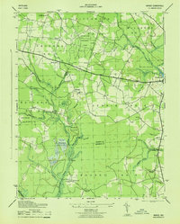
1943 Map of Wango
USGS Topo · Published 1943About this map
The lowlands of eastern Maryland are defined here by a dense network of drainage channels and small agrarian settlements along the Wicomico Co Worcester Co line during the 1940s. Centered on the Nassawango Creek watershed, the map reveals a landscape heavily managed for timber and agriculture, most notably within the Eastern Shore Experimental Forest. Small communities like Powellville and Wango are connected by narrow roads, with local life anchored by landmarks such as Mount Zion Church, Mount Olive Church, and the St Johns Cem.
Find a feature on this map
59 named features on this map. Tap any name to fly to it.
Don’t see what you’re looking for? This feature index may not catch every label — zoom into the map to look around manually.
Map Details
Editions of this 1943 Wango Map
This is the sole edition of this map. No revisions or reprints were ever made.
Other maps of this area

1901 · Snow Hill
USGS Topo · 1:62,500

1901 · Salisbury
USGS Topo · 1:62,500

1902 · Pittsville
USGS Topo · 1:62,500

1942 · Ninepin
USGS Topo · 1:24,000

1942 · Snow Hill
USGS Topo · 1:24,000

1942 · Wango
USGS Topo · 1:24,000

1942 · Wesley
USGS Topo · 1:24,000

1942 · Whaleysville
USGS Topo · 1:24,000

1942 · Dividing Creek
USGS Topo · 1:24,000

1942 · Salisbury
USGS Topo · 1:24,000