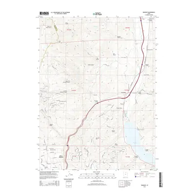
2014 Map of Wanship
USGS Topo · Published 2014About this map
Wanship and the surrounding high-country landscape of the Wasatch Range dominate this 2014 survey. The topography is defined by the Weber River valley, which cuts through the terrain to feed the expansive Rockport Lake. This reservoir, along with the adjacent Rockport Campground, indicates the region's importance for water management and recreation. To the west, the complex drainage systems of Tollgate Canyon and Alexander Canyon carve into The West Hills, showing a dense network of residential mountain roads such as Porcupine Loop and Hidden Hill Loop near Silver Summit. The map serves as a vital record for genealogists, documenting the Wanship Cemetery and Hoytsville Cemetery, while also marking prominent landmarks like Lewis Peak. The presence of major transport corridors like 80 underscores the area's role as a gateway through the mountain canyons.
Find a feature on this map
108 named features on this map. Tap any name to fly to it.
Don’t see what you’re looking for? This feature index may not catch every label — zoom into the map to look around manually.
Map Details
Editions of this 2014 Wanship Map
This is the sole edition of this map. No revisions or reprints were ever made.
Other maps of this area

1885 · Salt Lake
USGS Topo · 1:250,000

1900 · Coalville
USGS Topo · 1:125,000

1903 · Coalville
USGS Topo · 1:125,000

1925 · Ft. Douglas
USGS Topo · 1:125,000

1928 · Ft. Douglas
USGS Topo · 1:125,000

1954 · Salt Lake City
USGS Topo · 1:250,000

1955 · Park City East
USGS Topo · 1:24,000

1955 · Park City West
USGS Topo · 1:24,000

1958 · Salt Lake City
USGS Topo · 1:250,000

1960 · Salt Lake City
USGS Topo · 1:250,000