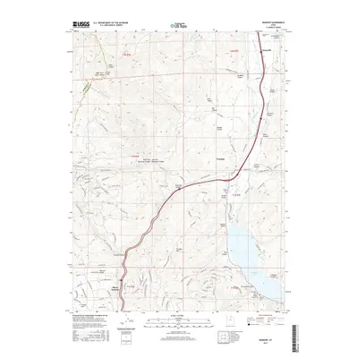
2017 Map of Wanship
USGS Topo · Published 2017About this map
The Weber River corridor serves as the primary artery for transport and settlement in this section of Summit County, connecting the communities of Hoytsville and Wanship. This 2017 study illustrates the modern landscape defined by the expansive Rockport Lake, where several small family and community burial grounds are located along the eastern shore, including the Cooper-Hughes-Vickory Cem and the Seymour-Davis Cem. The transition from the river valley to the surrounding peaks is marked by numerous named drainages such as Crandall Canyon and Alexander Canyon, while the residential growth of Tollgate Canyon is visible to the west.
Find a feature on this map
121 named features on this map. Tap any name to fly to it.
Don’t see what you’re looking for? This feature index may not catch every label — zoom into the map to look around manually.
Map Details
Editions of this 2017 Wanship Map
This is the sole edition of this map. No revisions or reprints were ever made.
Other maps of this area

1885 · Salt Lake
USGS Topo · 1:250,000

1900 · Coalville
USGS Topo · 1:125,000

1903 · Coalville
USGS Topo · 1:125,000

1925 · Ft. Douglas
USGS Topo · 1:125,000

1928 · Ft. Douglas
USGS Topo · 1:125,000

1954 · Salt Lake City
USGS Topo · 1:250,000

1955 · Park City East
USGS Topo · 1:24,000

1955 · Park City West
USGS Topo · 1:24,000

1958 · Salt Lake City
USGS Topo · 1:250,000

1960 · Salt Lake City
USGS Topo · 1:250,000