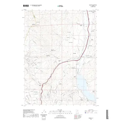
2020 Map of Wanship
USGS Topo · Published 2020About this map
The Weber River corridor serves as the central artery for this portion of the Wasatch Range near the settlement of Wanship. This modern survey documents the high-country landscape of Summit County where steep-walled canyons like Cottonwood Canyon and Alexander Canyon descend from peaks such as Lewis Peak. The presence of the Rail Trail following the river and the Old Lincoln Hwy highlights the enduring importance of this mountain passage for transit and recreation. Further south, the waters of Rockport Lake dominate the valley floor, surrounded by several family and community burial sites, including the Cooper-Hughes-Vickory Cem and Rockport Cem. The map provides a detailed view of the rural-residential interfaces along S Hoytsville Rd and the outskirts of Hoytsville, showing how modern developments have integrated into the rugged terrain of The West Hills.
Find a feature on this map
119 named features on this map. Tap any name to fly to it.
Don’t see what you’re looking for? This feature index may not catch every label — zoom into the map to look around manually.
Map Details
Editions of this 2020 Wanship Map
This is the sole edition of this map. No revisions or reprints were ever made.
Other maps of this area

1885 · Salt Lake
USGS Topo · 1:250,000

1900 · Coalville
USGS Topo · 1:125,000

1903 · Coalville
USGS Topo · 1:125,000

1925 · Ft. Douglas
USGS Topo · 1:125,000

1928 · Ft. Douglas
USGS Topo · 1:125,000

1954 · Salt Lake City
USGS Topo · 1:250,000

1955 · Park City East
USGS Topo · 1:24,000

1955 · Park City West
USGS Topo · 1:24,000

1958 · Salt Lake City
USGS Topo · 1:250,000

1960 · Salt Lake City
USGS Topo · 1:250,000