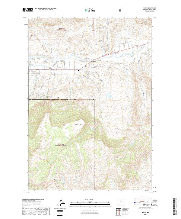
2021 Map of Wapiti
USGS Topo · Published 2021About this map
The settlement of Wapiti serves as the focal point of this modern survey, positioned where the North Fork Shoshone River valley widens between high mountain ridges. This area in Shoshone National Forest is defined by its network of historical and recreational pathways, including the Stagecoach Trl, Haman McCall Trl, and Big Cr Trl. The map illustrates the careful management of water in this semi-arid landscape via the N Fork Valley Ditch, while the local community is anchored by the Wapiti Valley Church and a nearby Cem. Dramatic geological formations such as the Chinese Wall and Table Mtn dominate the vertical relief, with numerous seasonal drainages like Whit Cr and Slack Cr feeding into the river system. These features indicate a landscape shaped by both early western transit routes and modern national forest conservation.
Find a feature on this map
61 named features on this map. Tap any name to fly to it.
Don’t see what you’re looking for? This feature index may not catch every label — zoom into the map to look around manually.
Map Details
Editions of this 2021 Wapiti Map
This is the sole edition of this map. No revisions or reprints were ever made.
Other maps of this area

1893 · Ishawooa
USGS Topo · 1:125,000

1895 · Ishawooa
USGS Topo · 1:125,000

1896 · Crandall Creek
USGS Topo · 1:125,000

1899 · Crandall
USGS Topo · 1:125,000

1899 · Ishawooa
USGS Topo · 1:125,000

1949 · Pat O'Hara Mountain
USGS Topo · 1:62,500

1955 · Cody
USGS Topo · 1:250,000

1956 · Dead Indian Peak
USGS Topo · 1:62,500

1957 · Wapiti
USGS Topo · 1:62,500

1958 · Cody
USGS Topo · 1:250,000