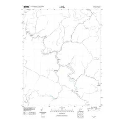
2011 Map of War
USGS Topo · Published 2011About this map
War and its neighboring coal towns define the deep valley landscape along the Dry Fork and War Creek. This 2011 survey documents the dense network of hollows and ridges characteristic of McDowell County, where small communities like Warriormine, Yukon, and Caretta are tethered to the winding river corridors. The infrastructure of these mountain settlements is anchored by essential facilities, including the English Post Office and Berwind Post Office, alongside the high-elevation Olga Number 2 Lookout Tower. To the south, the geography shifts toward recreation at Lake Berwind, where the Berwind Lake Dam impounds the waters of War Creek. The map provides a detailed view of the complex road systems, such as Berwind Mountain Rd and English Hollow Rd, which navigate the steep drainage patterns of Jacobs Fork and Barrenshe Creek.
Find a feature on this map
60 named features on this map. Tap any name to fly to it.
Don’t see what you’re looking for? This feature index may not catch every label — zoom into the map to look around manually.
Map Details
Editions of this 2011 War Map
This is the sole edition of this map. No revisions or reprints were ever made.
Other maps of this area

1891 · Tazewell
USGS Topo · 1:125,000

1895 · Tazewell
USGS Topo · 1:125,000

1897 · Tazewell
USGS Topo · 1:125,000

1910 · Iaeger
USGS Topo · 1:48,000

1912 · Pounding Mill
USGS Topo · 1:62,500

1912 · Iaeger
USGS Topo · 1:62,500

1912 · Welch
USGS Topo · 1:62,500

1914 · Iaeger
USGS Topo · 1:48,000

1915 · Richlands
USGS Topo · 1:48,000

1916 · Pounding Mill
USGS Topo · 1:62,500