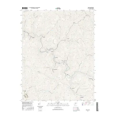
2016 Map of War
USGS Topo · Published 2016About this map
Dry Fork and the Norfolk Southern railway corridor define the rugged McDowell County landscape, where coal-mining history remains visible through the dense network of industrial roads and small valley settlements. The town of War serves as a central hub, surrounded by smaller communities such as Warriormine, Excelsior, and Rift. The influence of the mining industry is clearly marked by the presence of Warrior Mine Rd, while the local topography is carved by numerous watercourses including Barrenshe Cr and Jacobs Fork.
Find a feature on this map
86 named features on this map. Tap any name to fly to it.
Don’t see what you’re looking for? This feature index may not catch every label — zoom into the map to look around manually.
Map Details
Editions of this 2016 War Map
This is the sole edition of this map. No revisions or reprints were ever made.
Other maps of this area

1891 · Tazewell
USGS Topo · 1:125,000

1895 · Tazewell
USGS Topo · 1:125,000

1897 · Tazewell
USGS Topo · 1:125,000

1910 · Iaeger
USGS Topo · 1:48,000

1912 · Pounding Mill
USGS Topo · 1:62,500

1912 · Iaeger
USGS Topo · 1:62,500

1912 · Welch
USGS Topo · 1:62,500

1914 · Iaeger
USGS Topo · 1:48,000

1915 · Richlands
USGS Topo · 1:48,000

1916 · Pounding Mill
USGS Topo · 1:62,500