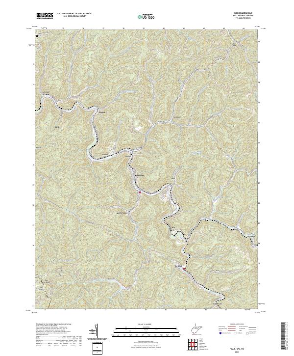
2023 Map of War
USGS Topo · Published 2023About this map
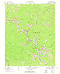
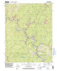
War and the surrounding coal-country communities along Dry Fork and War Creek are documented here in high detail. This map illustrates a landscape defined by the steep hollows and narrow valleys of the Appalachian Plateau, where residential pockets like Warriormine, Excelsior, and Berwind are squeezed between high ridges. The map reflects the region's industrial heritage through names like Warriormine and Tipple Bottom, following the intricate network of watercourses including Jacobs Fork and Big Creek. Natural features and local landmarks such as Williams Hill and Lake Berwind provide a frame for the smaller settlements of Caretta, Canebrake, and Cucumber. Genealogists and local historians can trace burial sites at Deskins Cem and the Lomax - Yukon Cem, which serve as quiet markers of the families who settled this corner of McDowell County.
Find a feature on this map
84 named features on this map. Tap any name to fly to it.
Don’t see what you’re looking for? This feature index may not catch every label — zoom into the map to look around manually.
Map Details
Editions of this 2023 War Map
This is the sole edition of this map. No revisions or reprints were ever made.