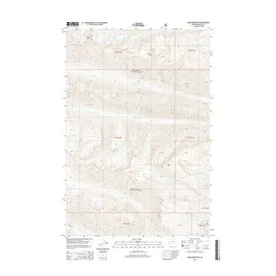
2014 Map of Ward Mountain
USGS Topo · Published 2014About this map
Bitterroot National Forest dominates this high-altitude landscape of western Montana, where the steep eastern slopes of the Bitterroot Mountains rise toward the Idaho border. The terrain is defined by dramatic glacial features, from the jagged heights of Canyon Peak and Downing Mtn to the deeply carved Coyote Coulee in the southeast. Numerous alpine basins hold small glacial lakes including High Lake, Wyant Lake, and the larger Camas Lake, which feeds into the intricate drainage system of the region.
Find a feature on this map
40 named features on this map. Tap any name to fly to it.
Don’t see what you’re looking for? This feature index may not catch every label — zoom into the map to look around manually.
Map Details
Editions of this 2014 Ward Mountain Map
This is the sole edition of this map. No revisions or reprints were ever made.
Other maps of this area

1901 · Hamilton
USGS Topo · 1:125,000

1956 · Hamilton
USGS Topo · 1:250,000

1959 · Hamilton
USGS Topo · 1:250,000

1960 · Hamilton
USGS Topo · 1:250,000

1964 · Hamilton
USGS Topo · 1:250,000

1964 · Hamilton South
USGS Topo · 1:24,000

1964 · Tenmile Lake
USGS Topo · 1:24,000

1964 · Darby
USGS Topo · 1:24,000

1964 · Ward Mountain
USGS Topo · 1:24,000
1964 · El Capitan
USGS Topo · 1:24,000