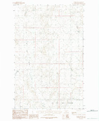
1984 Map of Wards Dam
USGS Topo · Published 1984About this map
The Fort Peck Indian Reservation dominates the southern landscape of this 1984 survey in Valley County, Montana. This high-plains terrain is defined by the winding course of the West Fork Porcupine Creek, which carves through the central portion of the quadrangle. A primary point of interest for local history and water management is Wards Dam, located in the western section of the map. This provisional map, compiled from aerial photography, provides a clear view of the rural topography and land divisions within the reservation boundaries during the mid-1980s, reflecting a quiet era of agricultural and tribal land use.
Find a feature on this map
3 named features on this map. Tap any name to fly to it.
Don’t see what you’re looking for? This feature index may not catch every label — zoom into the map to look around manually.
Map Details
Editions of this 1984 Wards Dam Map
This is the sole edition of this map. No revisions or reprints were ever made.
Other maps of this area

1919 · Boundary
USGS Topo · 1:125,000

1954 · Glasgow
USGS Topo · 1:250,000

1957 · Glasgow
USGS Topo · 1:250,000

1958 · Glasgow
USGS Topo · 1:250,000

1973 · Baylor
USGS Topo · 1:24,000

1973 · Opheim
USGS Topo · 1:24,000

1973 · Cameron Point
USGS Topo · 1:24,000

1984 · O'Juel Lake
USGS Topo · 1:24,000

1984 · Opheim
USGS Topo · 1:100,000

1984 · Dodge Reservoir
USGS Topo · 1:24,000