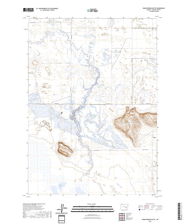
2024 Map of Warm Springs Butte
USGS Topo · Published 2024About this map
Malheur National Wildlife Refuge defines the southern reach of this landscape, where the waters of Malheur Lake and a complex network of wetlands form a critical high-desert habitat. The terrain is marked by prominent volcanic features like Warm Springs Butte and Saddle Butte, which rise above the surrounding basin. This area represents a unique hydrologic intersection where Ninemile Slough, Malheur Slough, and Hot Springs Slough weave through the sagebrush flats. Local history is anchored by the Saddle Butte Cem and the thermal waters of Crane Hot Springs. The map reveals a land structured by long-established ranching and transit routes such as Crane Blvd and Saddle Butte Rd, reflecting the remote, water-dependent settlement patterns of southeastern Oregon.
Find a feature on this map
21 named features on this map. Tap any name to fly to it.
Don’t see what you’re looking for? This feature index may not catch every label — zoom into the map to look around manually.
Map Details
Editions of this 2024 Warm Springs Butte Map
This is the sole edition of this map. No revisions or reprints were ever made.
Other maps of this area

1955 · Burns
USGS Topo · 1:250,000

1958 · Burns
USGS Topo · 1:250,000

1959 · Burns
USGS Topo · 1:250,000

1959 · Harney
USGS Topo · 1:62,500

1959 · Lawen
USGS Topo · 1:62,500

1960 · Crane
USGS Topo · 1:62,500

1973 · Mahon Creek
USGS Topo · 1:24,000

1973 · Carson Point
USGS Topo · 1:24,000

1978 · Malheur Lake
USGS Topo · 1:100,000

1978 · Stinkingwater Mountains
USGS Topo · 1:100,000