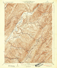
1933 Map of Warm Springs Run
USGS Topo · Published 1933About this map
Warm Springs and Hot Springs anchor this 1930s topographic study of the Alleghany mountain landscape in Bath County. The map details the valley floor where State Highway No 800 and State Highway No 804 navigate the steep rises of Warm Springs Mountain and Coles Mtn. This era shows a settled corridor of small communities and rural institutions, including Thomastown and Mitchelltown, alongside essential local landmarks like Mt Hope Ch and the Thomastown Sch. The Jackson River cuts a prominent path through the northwest, while numerous creeks like Muddy Run and Hot Springs Run drain the surrounding ridges. Notable for genealogists and local historians, the map captures the spatial relationship between the primary resorts and smaller hamlets such as Bacova and Bacova Junction before mid-century infrastructure changes.
Find a feature on this map
49 named features on this map. Tap any name to fly to it.
Don’t see what you’re looking for? This feature index may not catch every label — zoom into the map to look around manually.
Map Details
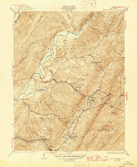
Editions of this 1933 Warm Springs Run Map
3 editions found

Other maps of this area

1894 · Natural Bridge
USGS Topo · 1:125,000

1901 · Monterey
USGS Topo · 1:125,000

1923 · Warm Springs
USGS Topo · 1:48,000

1926 · Warm Springs
USGS Topo · 1:62,500

1929 · Falling Spring
USGS Topo · 1:24,000

1930 · Warm Springs Run
USGS Topo · 1:24,000

1930 · Mountain Grove
USGS Topo · 1:24,000

1931 · Healing Springs
USGS Topo · 1:24,000

1932 · Falling Spring
USGS Topo · 1:31,680

1933 · Mountain Grove
USGS Topo · 1:31,680