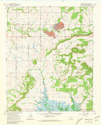
1963 Map of Warner NW
USGS Topo · Published 1981About this map
The Indian Treaty Boundary bisects this portion of McIntosh County, reflecting the deep tribal history of the area between the Checotah and Cobb districts. At the time of this 1963 survey, the southern landscape was undergoing a significant transformation with the filling of Eufaula Lake, its rising waters reaching into the valleys of Duchess Creek and Mud Creek. To the north, the industrial footprint is visible through an active Strip Mine and the remnants of an Old Railroad Grade near Elk Creek. This map is particularly valuable for genealogical research, documenting several dispersed burial grounds including Vandier Cem, Paradise Cem, and McNaulty Cem. Educational and religious centers like Central High School and the Assembly of God Church serve as anchors for the rural community nestled between Neb Mountain and Beck Mountain.
Find a feature on this map
21 named features on this map. Tap any name to fly to it.
Don’t see what you’re looking for? This feature index may not catch every label — zoom into the map to look around manually.
Map Details
Editions of this 1963 Warner NW Map
3 editions found

Other maps of this area

1896 · Okmulgee
USGS Topo · 1:125,000

1900 · Sansbois
USGS Topo · 1:125,000

1900 · Canadian
USGS Topo · 1:125,000

1900 · Okmulgee
USGS Topo · 1:125,000

1901 · Muscogee
USGS Topo · 1:125,000

1905 · Muscogee
USGS Topo · 1:125,000

1909 · Sans Bois
USGS Topo · 1:125,000

1911 · Sansbois
USGS Topo · 1:125,000

1946 · Fort Smith
USGS Topo · 1:250,000

1948 · Keefeton
USGS Topo · 1:62,500