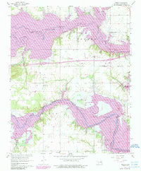
1962 Map of Pierce
USGS Topo · Published 1989About this map
Eufaula Lake dominates this McIntosh County landscape, its waters filling the valleys of the North Canadian River and the Deep Fork river system. The map documents a period of significant geographical transition, showing areas marked for controlled inundation as the reservoir system altered the Oklahoma terrain. Small settlements and local gathering places remain as anchors of the community, including Richardsville to the north and Pierce and Fame further south.
Find a feature on this map
23 named features on this map. Tap any name to fly to it.
Don’t see what you’re looking for? This feature index may not catch every label — zoom into the map to look around manually.
Map Details
Editions of this 1962 Pierce Map
4 editions found
Other maps of this area

1896 · Okmulgee
USGS Topo · 1:125,000

1900 · Canadian
USGS Topo · 1:125,000

1900 · Okmulgee
USGS Topo · 1:125,000

1946 · Fort Smith
USGS Topo · 1:250,000

1962 · Raiford
USGS Topo · 1:24,000

1962 · Pierce
USGS Topo · 1:24,000

1962 · Hoffman
USGS Topo · 1:24,000

1963 · Stidham
USGS Topo · 1:24,000

1963 · Eufaula
USGS Topo · 1:24,000

1963 · Checotah
USGS Topo · 1:24,000