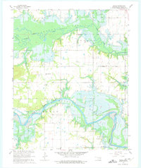
1962 Map of Pierce
USGS Topo · Published 1975About this map
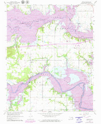
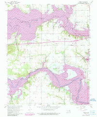
Eufaula Lake dominates this landscape, showing the planned inundation of the Deep Fork and North Canadian River valleys. Blue hatching indicates vast areas designated for submergence at the 585-foot elevation, a transformation of the Oklahoma terrain that redefined local boundaries and access. Despite the rising waters, the survey preserves the locations of established rural communities and educational centers, including Richardsville, Brush Hill, and Stidham. Genealogy researchers will find significant value in the documentation of several family and community burial grounds, such as Larbliance Cem, McNik Cem, and Pierce Cem. The map also traces the community infrastructure of the mid-20th century, marking the Pierce High School, Warrior School, and local religious sites like Galilee Church. Fine red dashed lines throughout the quadrangle provide a distinct record of field and fence lines as they appeared during 1959 aerial photography.
Find a feature on this map
25 named features on this map. Tap any name to fly to it.
Don’t see what you’re looking for? This feature index may not catch every label — zoom into the map to look around manually.
Map Details
Editions of this 1962 Pierce Map
4 editions found
Other maps of this area

1896 · Okmulgee
USGS Topo · 1:125,000

1900 · Canadian
USGS Topo · 1:125,000

1900 · Okmulgee
USGS Topo · 1:125,000

1946 · Fort Smith
USGS Topo · 1:250,000

1962 · Raiford
USGS Topo · 1:24,000

1962 · Pierce
USGS Topo · 1:24,000

1962 · Hoffman
USGS Topo · 1:24,000

1963 · Stidham
USGS Topo · 1:24,000

1963 · Eufaula
USGS Topo · 1:24,000

1963 · Checotah
USGS Topo · 1:24,000