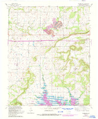
1963 Map of Warner NW
USGS Topo · Published 1993About this map
Indian Treaty Boundary lines cut across this Oklahoma landscape, marking the historic division of territory north of Eufaula Lake. The map reveals a transition from the agricultural plateaus to the industrial activity of a prominent Strip Mine situated near Shady Grove Creek. Evidence of early transportation is visible along the Old Railroad Grade as it winds north of Nebo Mountain. Small rural centers are defined by local landmarks like Central High Sch and Prairie View Sch, while several family cemeteries, including Vandiver Cem and McNaulty Cem, provide critical touchstones for genealogical research in this part of McIntosh County. The southern edge of the sheet is dominated by the rising waters and inlets of the reservoir, including a dedicated Boat Ramp for lake access.
Find a feature on this map
21 named features on this map. Tap any name to fly to it.
Don’t see what you’re looking for? This feature index may not catch every label — zoom into the map to look around manually.
Map Details
Editions of this 1963 Warner NW Map
3 editions found

Other maps of this area

1896 · Okmulgee
USGS Topo · 1:125,000

1900 · Sansbois
USGS Topo · 1:125,000

1900 · Canadian
USGS Topo · 1:125,000

1900 · Okmulgee
USGS Topo · 1:125,000

1901 · Muscogee
USGS Topo · 1:125,000

1905 · Muscogee
USGS Topo · 1:125,000

1909 · Sans Bois
USGS Topo · 1:125,000

1911 · Sansbois
USGS Topo · 1:125,000

1946 · Fort Smith
USGS Topo · 1:250,000

1948 · Keefeton
USGS Topo · 1:62,500